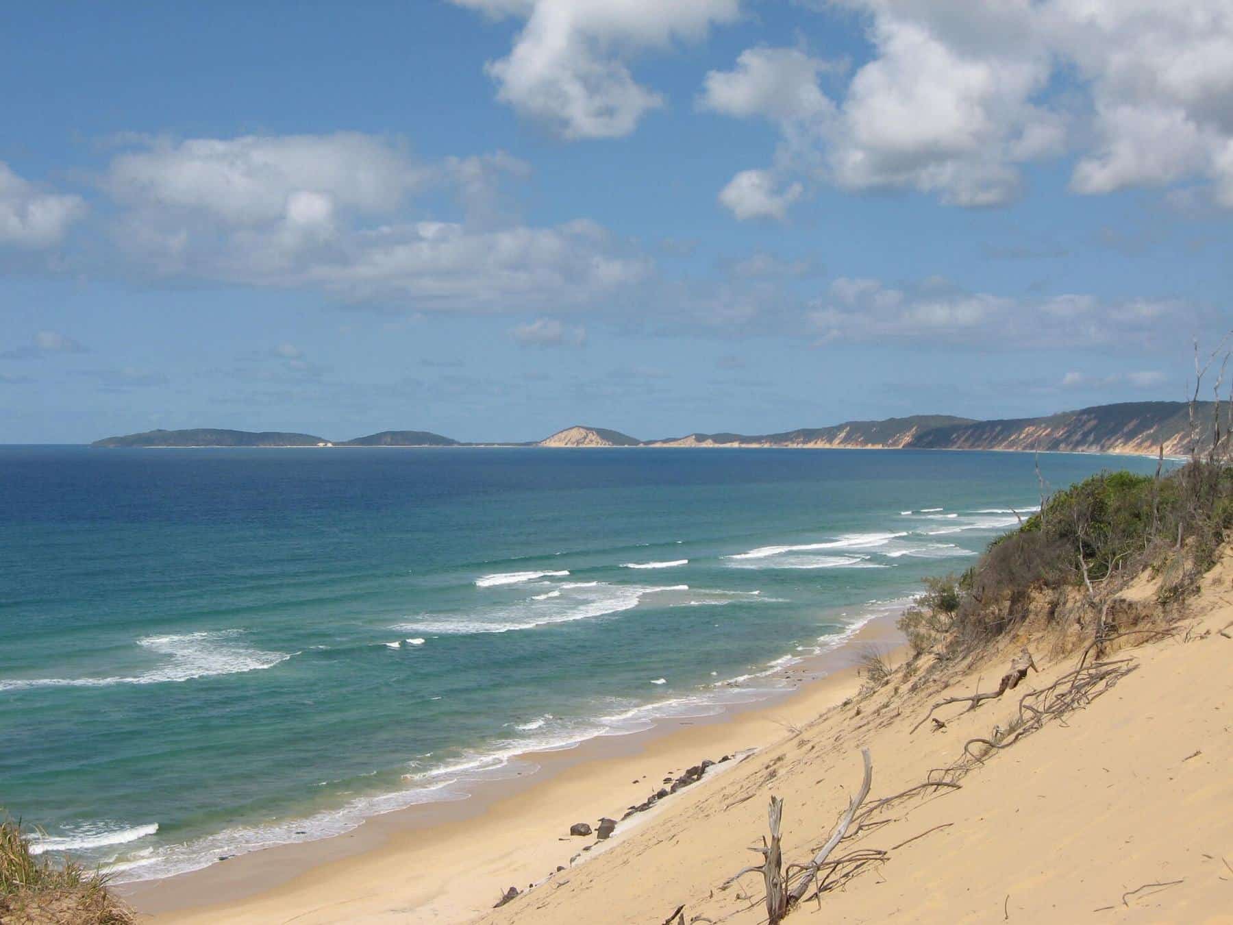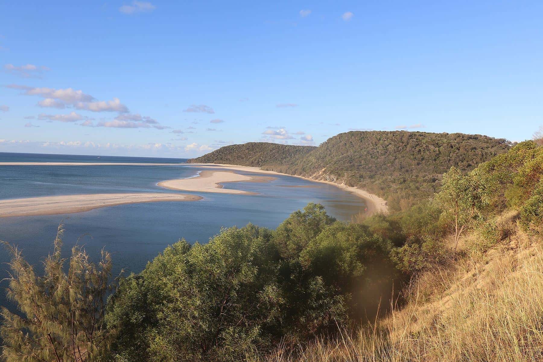
Double Island Point breaks the long, straight sand coast between Noosa and Rainbow Beach. A knob of hard rock stands about 30 kilometres south of Rainbow Beach by beach, and the sand has piled up around it to create a lagoon, a point break and a natural lookout over the Coral Sea. For many visitors, driving the beach to Double Island Point is the highlight of a trip to the Cooloola Coast.
1884
Lighthouse
First lit on 11 September 1884
2.2 km
Lighthouse walk
Return, about 1 hour
57 ha
Lightstation reserve
Queensland Heritage Register
The lighthouse
In the early 1880s the Queensland government was building a chain of lights along its coast as shipping grew. A light at Double Island Point was recommended for vessels entering Wide Bay. The marine engineer G. P. Heath inspected the site in January 1883 and recommended placing the light on top of the headland for a wider outlook. The contract went to builder W. P. Clark, who built several Queensland lighthouses, and the light was first exhibited on 11 September 1884. According to the Queensland Heritage Register, it was the 18th lighthouse built by the Queensland government.
Lighthouse keepers and their families lived on the headland for decades, relying on supply boats and the beach for contact with the outside world. The light was later automated. The lightstation reserve of about 57 hectares, covering the high rocky land of the point, is heritage-listed.
The lighthouse walk
QPWS lists the Double Island Point lighthouse walk as 2.2 kilometres return, about an hour, graded as a Grade 3 track. It is short but steep. Start from the beach at the southern side of the point. At the top you can walk around the lighthouse and keepers’ buildings and enjoy 360-degree views that, on a clear day, reach K’gari to the north and Noosa to the south. In winter and spring, watch for humpback whales offshore.
The lagoon
On the northern side of the point, a sand spit encloses a shallow, sheltered lagoon. At low tide it is a warm, calm pool of turquoise water, perfect for paddling, swimming and snorkelling. Rays, small fish and turtles are often seen. Remember that the lagoon is not patrolled and that currents can run through its entrance as the tide changes.
Surfing
Double Island Point is known for its long right-hand point break, which wraps around the headland in south-east swells. On good days it attracts surfers from across south-east Queensland, while smaller days suit longboarders. The beaches on either side also have breaks for different conditions. There are no lifeguards, so surf within your ability.
Getting there
By 4WD from Rainbow Beach
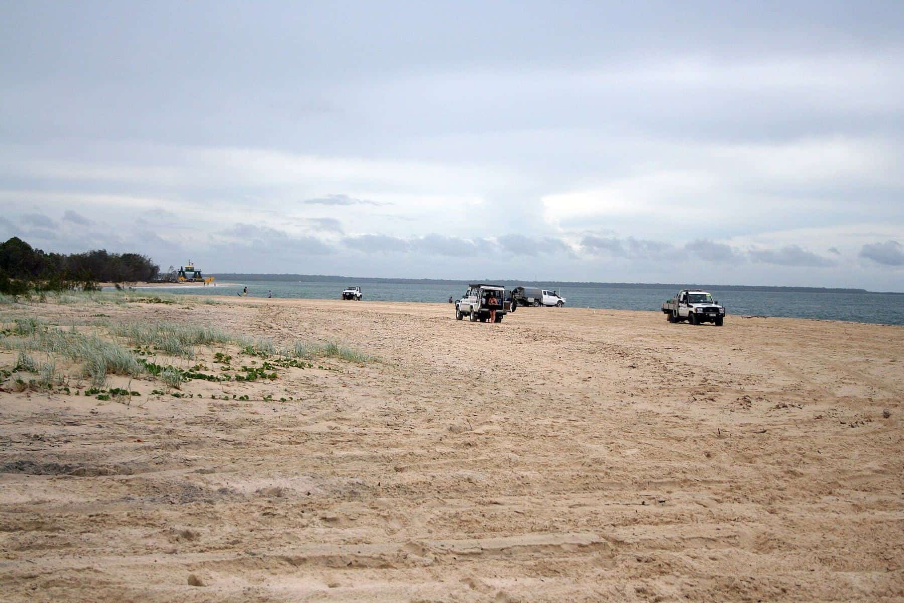
The beach south of Rainbow Beach is a gazetted road within the Cooloola Recreation Area, and a QPWS vehicle access permit is required. The route passes the coloured sands and must get past Mudlo Rocks, a rocky headland just south of town. QPWS warns that Mudlo Rocks is often impassable even at low tide and should be attempted only by experienced drivers. The alternative is the inland Freshwater Road, which joins the beach further south. Read our beach driving guide.
By 4WD from Noosa
From Tewantin, take the ferry across the Noosa River to Noosa North Shore and drive north along Teewah Beach, roughly 50 kilometres to the point.
On a tour
Several operators run guided 4WD tours from Rainbow Beach and Noosa to Double Island Point, often combining it with the coloured sands and the lagoon. This is the easiest option if you are new to beach driving.
Beach-driving tide window
Enter the time of low tide from the official tide tables. QPWS advises driving within about two hours either side of low tide.
Start driving after
8:30 am
Low tide
10:30 am
Be off the beach by
12:30 pm
A planning aid only. Swell, wind and soft sand can make the beach unsafe even inside this window, and Mudlo Rocks is often impassable even at low tide. Always check QPWS park alerts and use your own judgement.
Leisha Track
Vehicles cross the neck of the headland on the Leisha Track, an inland sand track linking the southern beach with the northern beach and lagoon. The track can be soft, steep and rutted. Lower tyre pressures appropriately, drive slowly and give way as signposted.
Camping and facilities
There is no camping on the headland itself. QPWS campgrounds are located at Freshwater and in the Teewah Beach camping zones to the south, and at Inskip Point to the north, all requiring permits. Facilities at the point are minimal, so bring water, food and a rubbish bag.
Double Island Point day trip checklist
0 of 7 done
Ticks are saved in this browser only.
Nearby
Experienced divers can explore Wolf Rock, just offshore. On the way back to town, stop at the coloured sands.
Frequently asked questions
How do you get to Double Island Point?
By 4WD along the beach from Rainbow Beach (via Mudlo Rocks, when passable) or from Noosa North Shore via Teewah Beach, or on a guided tour. You need a QPWS vehicle access permit and should drive within about two hours of low tide.
How long is the Double Island Point lighthouse walk?
QPWS lists the lighthouse walk as 2.2 kilometres return, allowing about an hour. It is short but steep, with 360-degree views from the top.
When was the Double Island Point lighthouse built?
The lighthouse was built in 1884 and its light was first exhibited on 11 September 1884. It was the 18th lighthouse built by the Queensland government and is listed on the Queensland Heritage Register.
Is the Double Island Point lagoon safe for swimming?
The lagoon on the northern side of the point is sheltered and popular for swimming and snorkelling, but it is not patrolled. Watch for tidal currents near its entrance and supervise children closely.
Sources and further reading
Facts on this page were checked against these primary and official sources. Conditions change — confirm before you travel or buy.
- Double Island Point lighthouse walk — Queensland Parks and Wildlife Service
- Double Island Point Lightstation (Queensland Heritage Register 601722) — Queensland Government
- Cooloola Beach drive — Queensland Parks and Wildlife Service